Aid workers in Haiti are using Google Earth to track the needs of earthquake survivors in hundreds of makeshift camps, pioneering a technique which could be used in future emergencies.
Relief teams log on to Google Earth from camps and upload information about water, food, shelter and population movements, providing an instant snapshot, along with global positioning, of conditions on the ground.
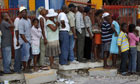
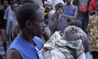
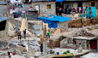
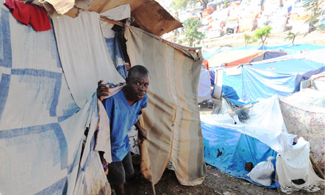
The information is fed into www.cccmhaiti.info, with a link to maps of many of the 414 settlement camps and tent cities which host 600,000 people left homeless by the 12 January quake.
"The humanitarian agencies have some catching up to do when it comes to things like Skype and handheld email," said Alex Wynter, a Red Cross spokesman in Haiti. "But in the base camps, we're connected and disaster relief is going online."
Mapping experts started the project shortly after the magnitude 7.0 quake devastated Port-au-Prince and killed, according to the government, more than 230,000 people. They teamed up with civil engineers and Haitian geographers who knew local boundaries and street names.
Over a normal Google Earth screen of Haiti, blue spots show where Haitians have settled. Some are named by street, zone or landmark, and others are simply numbered as "IDP" internally displaced persons camps.
When a blue spot is clicked an information box appears giving a site's longitude and latitude, commune and estimated number of families and individuals. The details are updated regularly so that, in theory, charities and government officials can foresee aid shortfalls, and potential dangers such as landslides and floods.
"It is the first time a tool of such sophistication has been deployed in such short order by humanitarian actors after a major emergency," said Jean-Philippe Chauzy, a spokesman for the International Organisation for Migration (IOM), which teamed up with Google and the UN and humanitarian information body, iMMAP, on the project.
Aid workers hope it will speed a relief effort dogged by poor co-ordination between multiple charities, UN agencies and government efforts.
There are glitches in the new system, making navigation sometimes cumbersome. Information must be harmonised, said Brian Kelly, an IOM official involved in the project. "That's the next logical step."
The idea was to identify needs and to give policymakers and ordinary people a clearer view of relief efforts. "It gives you a quick snapshot: 'Hey, look, there's no water there,'" Kelly said.
"A lot of time and effort goes into logistics. If you don't know what's coming, where to take it, you are in trouble. We need to understand, not in month three but in week two, where people have moved and what their conditions are. This is going to cut through a lot of bureaucracy."
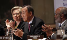
Google did not comment. A UN spokeswoman, Elisabeth Byrs, praised the company for delivering images so quickly after the earthquake, first by satellite and then enhanced by shots from the ground.
Aid agencies hope the maps will help identify refuges from the looming, rainy season, which is expected to bring floods and landslides.